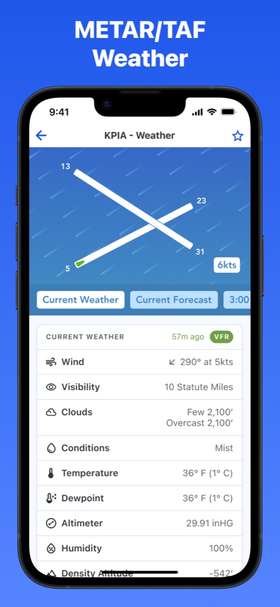

New in PilotPal: Weather and wind maps. PilotPal now pulls in the official METAR and TAF for any airport, parses them into a readable table, calculates density altitude for the field, and animates wind across the map so you can pick a runway at a glance.
METAR and TAF in 60 seconds
A METAR is the standard hourly weather observation for an airport. One compact line covers wind, visibility, sky condition and ceiling, temperature and dewpoint, and the altimeter setting. It's what's happening at the field right now.
A TAF is the forecast for the same airport, usually valid for the next 24 or 30 hours and broken into change groups (FM, BECMG, TEMPO, PROB) that describe how conditions are expected to shift over time. It's what to expect at your ETA.
Both are written in compressed code: fast to transmit, slower to read without practice.
What's new in PilotPal
Parsed METAR, not raw text
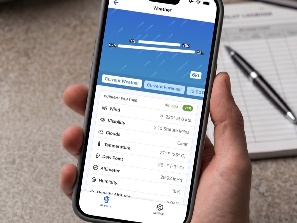
PilotPal parses the METAR into labeled fields instead of leaving it as one line of code. Tap an airport and you'll see wind, visibility, ceiling, temperature, dewpoint, and altimeter each on their own row, so there's nothing to decode in your head before you can use it. The raw METAR is still there if you want it.
Forecast broken into time blocks
We split the TAF into separate time blocks instead of one long string. Each block shows what to expect during a specific time window, so you can scroll to your arrival time and read it like a normal weather report. Like METAR, the raw TAF is still available too for reference.
Density altitude, calculated for you
Density altitude is pressure altitude corrected for non-standard temperature. It affects takeoff roll, climb rate, and engine power, especially on hot days at higher-elevation fields. We calculate it from the airport's elevation and the latest METAR temperature and pressure, and show it right alongside the current weather.
Wind animated across the map
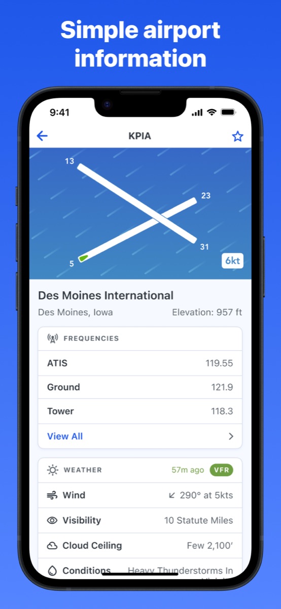
We added an animated wind layer to the airport map, driven by the current METAR. Direction and speed are visible at a glance against the runway headings, so picking a runway for takeoff or landing is a quick visual check instead of a crosswind calculation.
Get PilotPal
Grab the latest PilotPal update on your iPhone or iPad to get all our new weather features!

PilotPal: Airport Facility Directory
The cleanest pilot companion app out there
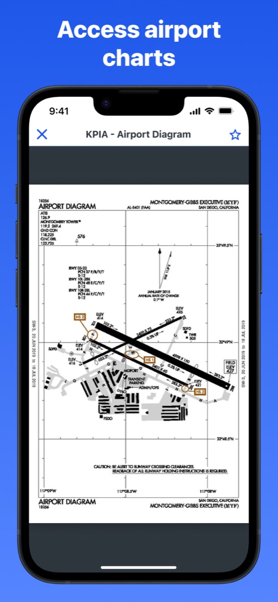
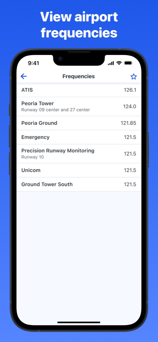
Look up airports by identifier and get parsed METAR and TAF, calculated density altitude, animated wind on the map, plus elevation, frequencies, and airport diagrams. Built around being fast to read at a glance.